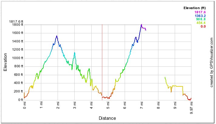
This shows the elevation profiles from two hikes, as if one were a continuation of the other.
On the left, the 2010 version, where we stopped at what my Magellan thought was about 1500 feet to eat and turn back. The Magellan always comes out with a shorter hike length than most other GPSs do, so figure at least five miles.
The next almost 5˝ miles (think 6+) are from the 2009, longer and higher hike, with the long GPS gap.
 Back to map
 Back to listing