 |
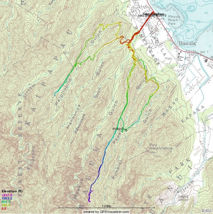
This map tracks three hikes. The shorter one to the west is the trail-clearing expedition on the Hau`ula
Double Loop trail. To the east, overlapping tracks of the 2009 and 2010 hikes. In 2010 most everyone stopped for lunch and to turn
around where the thick purple line ends between the two "U"s of "H A U U L A." In 2009, a few of us continued to where
the track ends a bit farther south (1818' color)
My Magellan conked out from about there to almost all the way
around the loop on the return. In 2010, it recorded all.
POI017 is where Tom told me there was a big pine (which
I saw; and in 2013 took these picures of) and a waterfall and/or a pool (which I didn't see).
 Back to listing Back to listing
 To profiles To profiles |