|
|
Here is a google map combining the 2011 and 2012 versions of the hike. The green track is 2011,
made with a Magellan Explorist 500, and goes clockwise. The red one is 2012 on a Magellan Explorist 310, which for the most part seems an improvement over the 500,
and goes counterclockwise. The only significant disagreement is at the "9 o'clock position," where enlarging the map shows that we went straight down the ridge in 2011
but took switchbacks coming up in 2012.


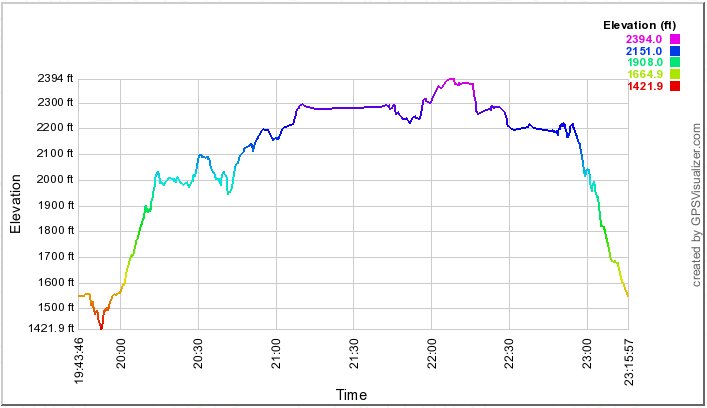
The profile below shows how we spent our time (Subtract 10 hours for local time).
The flat line 11:20 to 11:45 marks lunch, overlooking Makua Valley. |