

 Start 2011
Start 2012
Start 2011
Start 2012 |
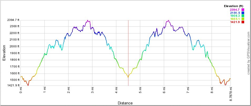
I was interested in comparing distance/elevation profiles for the two hikes. Here the 2012 hike, starting downhill, is on the left, and 2011 starting uphill is on the right. |
|
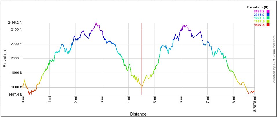
I was also interested in comparing in the difference between getting elevation from a government survey versus what the GPS itself reported, so here are what the Magellan Explorist 310 came up with for the 2012 hike on the left, and what my old (lost) Magellan Explorist 500 came up with in 2011, on the right. |
|
Start 2011
Start 2012 |