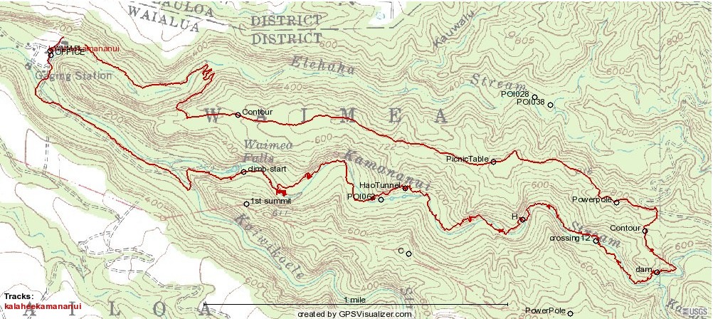
The points labelled "Contour" are where the ends of an old contour road along the south side of the ridge meet the hike trail.
The two points labelled "Power Pole" hold the wires with the balls on them that pass directly over the third stream crossing, going downstream (the tenth, going upstream. "Crossing 12" is the last one going upstream, except for one crossing the tributary if heading for North Ridge/Alaheʻe).
"Climb-start" is where one heads up to South Ridge for two other hikes we do in Waimea, reaching the top at "1st summit."
Oops! "HaoTunnel" is a terrible misspelling for "HauTunnel"!

