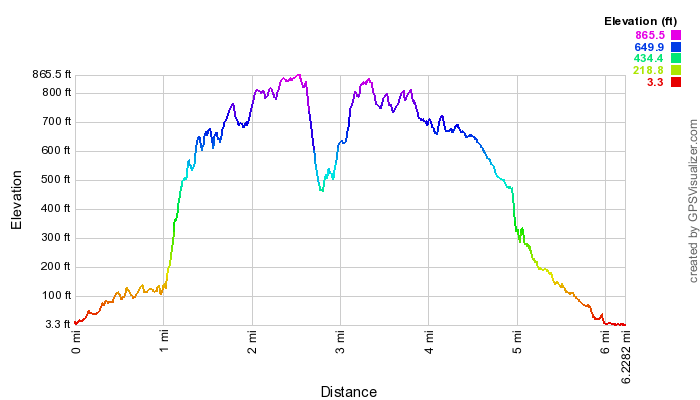
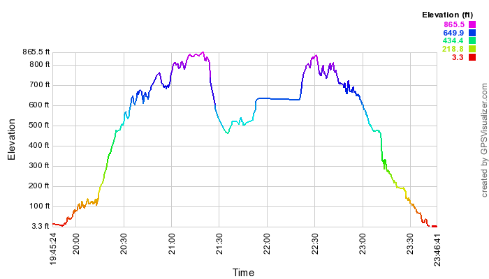
Below, enlargeable elevation-by-distance and elevation-by-time profiles for the 2013 hike.
I'm not sure what POI106 marks, but quite likely the major pig wallows.


| This topo map can by changed to a Google map (allowing much greater zoom-in capability),
as well as various other map forms, selecting from the menu upper right.
Below, enlargeable elevation-by-distance and elevation-by-time profiles for the 2013 hike. I'm not sure what POI106 marks, but quite likely the major pig wallows. |