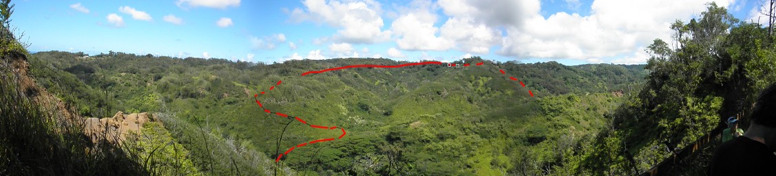
So, where does the Cattle Chute go?
The turn onto the Cattle Chute trail from ʻElehāhā Stream valley (aka "North Valley") is directly north of the lunch spot.
I have tried to guess where we went in the panorama photo below, marking with red dashes. What do you think?
By the way, you can zoom in and out, slide around, and toggle the tracks on and off by clicking on their name in the box. I have included the badly messed-up 2012 track only because it shows an alternate way back, down ʻElehāhā Stream; I suggest turning it off to see the better tracks. (I took a slightly different route on the last approach to Pūpūkea Road, where the red and green diverge.) And you can select map type by clicking and scrolling on "Google hybrid"; I recommend "US topo+relief (CalTopo)."