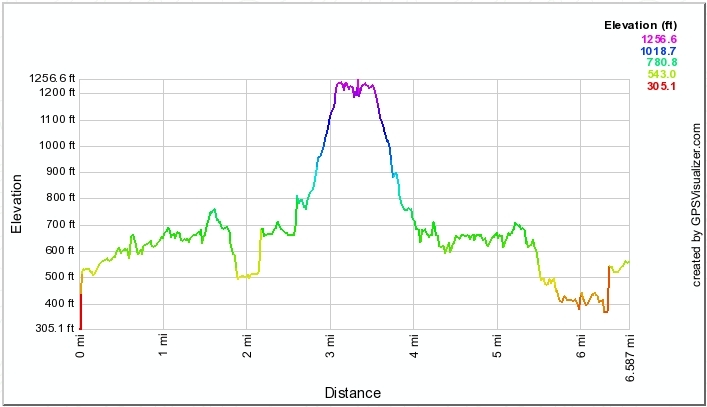
The distance/elevation profile below shows that the splinter group did about 6˝ miles. Most others hiked farther, I believe.


| GPS stuff |
|
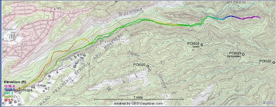
| This is the route some of the splinter group followed. The Boy Scout shelter is in the saddle
just above and to the right of POI024, which is the usual lunch spot for Halapepenui. A few of us went up the ridge and had lunch at
the end of it. Most others followed the Waimano trail, labeled near the stream just above the high point of the ridge.
Some of us took the lower trail on the way back, and that's what accounts for the yellow and orange track on the left, not GPS error.
The distance/elevation profile below shows that the splinter group did about 6˝ miles. Most others hiked farther, I believe. |
|
|
|