The red track is from June 2012, counterclockwise to start but aborted at the first major stream crossing due to heavy current and unknown depth. This track was made with a Magellan Explorist 310, generally a better tracker than the older 500, but it got really lost at the first shallow stream crossing area, either on the way out, or the way back, or both.
The red marker to the right marks the top of a steep down trail that I think might come out on the contour trail that was intended as the end of the loop part of the hike, after a second stream crossing that would probably also have been doubtful.
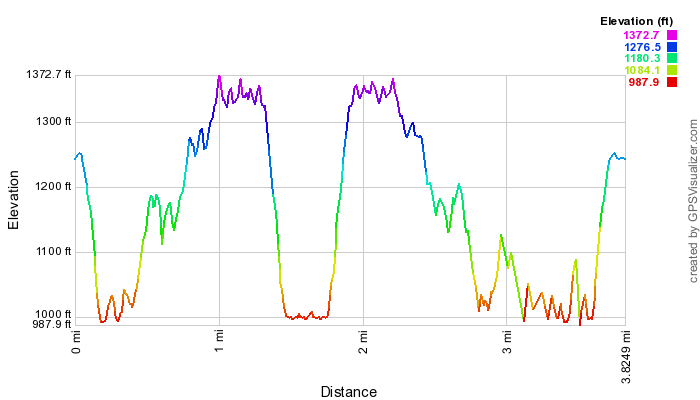
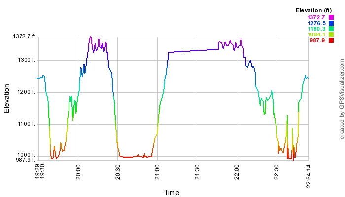
Below, elevation by distance and elevation by time profiles for my 2012 hike.