The earlier (blue) track shows our first exploration of a new trail made by bikers, and we reversed our steps once we got to the final climb to the saddle.
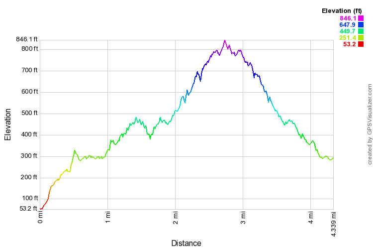
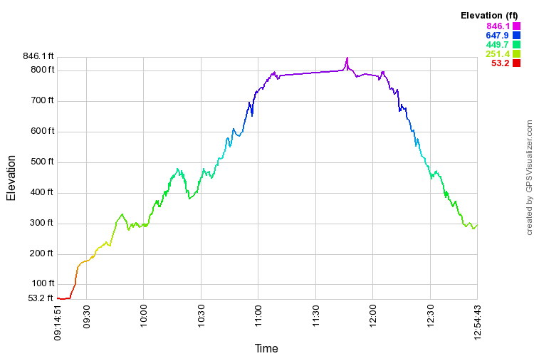
Below are (zoomable) distance and time profiles of my hike. They are flawed as information because I backtracked at least twice to see if others were coming, and my GPS batteries failed on me before getting back to the start. The actual hike distance would be less than twice the distance from the start to where we had lunch and turned back.
The later (red) track shows the outing with Solemates a week later. The portion from the ditch trail to the start of the bike path differs. A woman involved with the bike trail took the lead up "Anne's Trail" when I debated whether that was the way to go or not.
This time I went almost to the bottom of the third peak before I realized I had missed the overgrown left turn along the ridge, and headed back, joining John on part of the trail we used to use for this hike. Again my GPS battery quit on me, just before we rejoined the bike path.