


This is the 2009 version. Karen L. and I started in the direction of Lanipō proper, but soon gave up because of the cloudiness that would leave no view whatwoever.
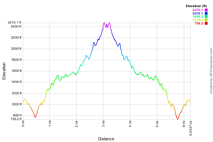
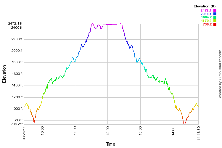
Below, distance, time, and elevation profiles for the mapped hike, 2009.
| Map and Profiles | |
| This is a live Google map; zoom in or out, change map type, whatever. This is the 2009 version. Karen L. and I started in the direction of Lanipō proper, but soon gave up because of the cloudiness that would leave no view whatwoever. Below, distance, time, and elevation profiles for the mapped hike, 2009. |
 |
 |