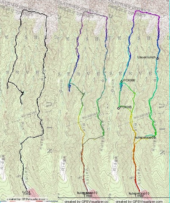
The one in the middle combines that Bushnell track, turned gray, with that of my Magellan Explorist 500. They coincide pretty well, with the Bushnell track on top sometimes erasing the Magellan.
On the right a combination of the 2009 and 2010 loops. In 2010 a few of us took an early trail back to the valley. In 2009 I went down the usual way, from POI065. (In 2009, I didn't turn my GPS on until late, and it started recording on the initial steep climb.)


