|
 |
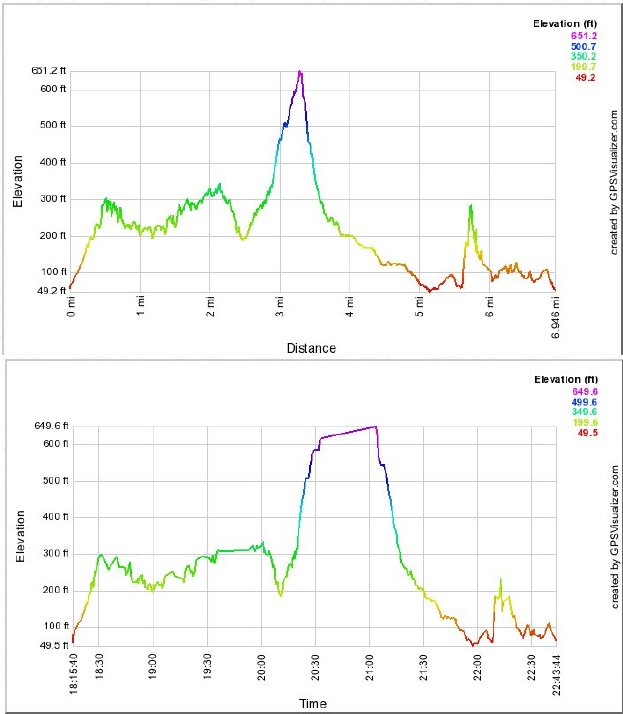 |
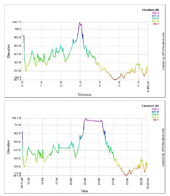
Magellan distance and time on the left, Bushnell on the right. This is their closest agreement on distance so far.
The Magellan went downhill a bit and the Bushnell uphill while they were actually stopped for a breather and lunch
from about 10:30 (subtract 10 hours from chart times to get Hawaiian time) to 11:15.
Here is a strange: the Bushnell does
not record altitude or time info. It gets altitude from another source at GPSvisualizer.com, but I had to run
the Magellan .log file along with the Bushnell to get the time chart! Presumably that is why the two Bushnell charts'
elevations don't exactly agree.
|
Back to GPS stuff list

|