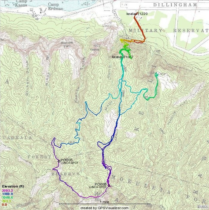
The route taken October 2009 is the shortest version that includes the two lunch spots (8.23 miles?), except for those who added a mile (half-mile in, half-mile out) down the northwest rim of Makua Valley.


Kelvin's topo map
|
Tracks from December 2007 and October 2008.
The route taken October 2009 is the shortest version that includes the two lunch spots (8.23 miles?), except for those who added a mile (half-mile in, half-mile out) down the northwest rim of Makua Valley. Kelvin's topo map |