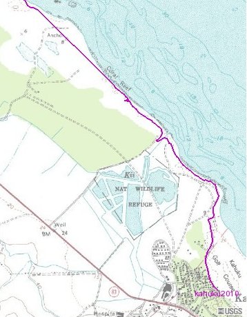
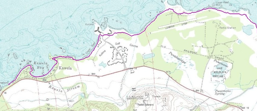
but I break it in two to fit better.
This shows the starting point,
labeled "Kahuku 2010," and the stream
crossing as a dip to SW where
I walked a bit upstream looking for shallows.
Most of the rest can be seen below.
| More detailed GPS tracks |
|
| Here is a more detailed map, but I break it in two to fit better. This shows the starting point, labeled "Kahuku 2010," and the stream crossing as a dip to SW where I walked a bit upstream looking for shallows. Most of the rest can be seen below. |
|
 |
  |