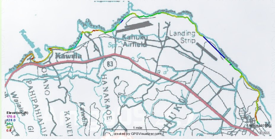


The colors supposedly indicating altitude can be used to match this map with the time profile below.
| GPS track 1 | |
|
|
| My GPS did a little better in 2010, seen here, than in 2009, when it had me flying in great swoops
over the Pacific once I got half way around Kawela Bay. In this 2010 version, the only bizarre error is that 2/3 of a mile
near the landing strip where it has me going along in a straight line about 130 feet in the air. The colors supposedly indicating altitude can be used to match this map with the time profile below. |
Ł
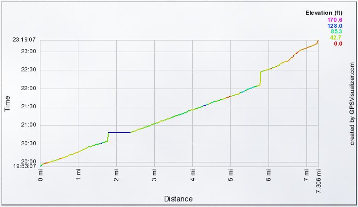 |
The times given on the left are Universal Standard Time; subtract 10 hours to get Hawaii Time.
Where I stopped for lunch--no forward progress from about 12:05 to 12:27--was the end of Kawela Bay, with still about a mile an d a half to go. I'm a bit surprised to see what a steady pace I maintained until after lunch. The apparent lack of motion from about 10:35 to 10:50 is spurious, GPS error. |