Light blue-green: 2012 version. In 2009 and 2012, I took the early turn across the valley between the shelter and Hahaʻione.
Red: 2013 route with one major difference: we followed the road up the valley past the first turn across to where the road itself used to cross the stream and turn back, except the turn is now washed out.


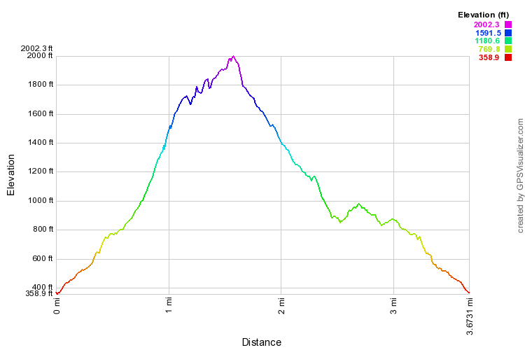
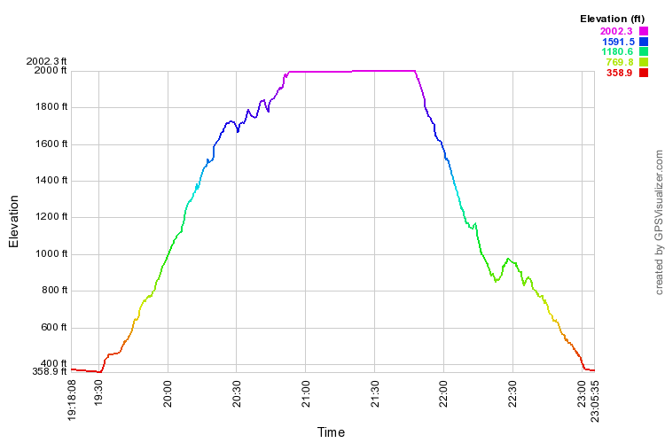
I'm going to try to squeeze two enlargeable profiles (distance and time) below.