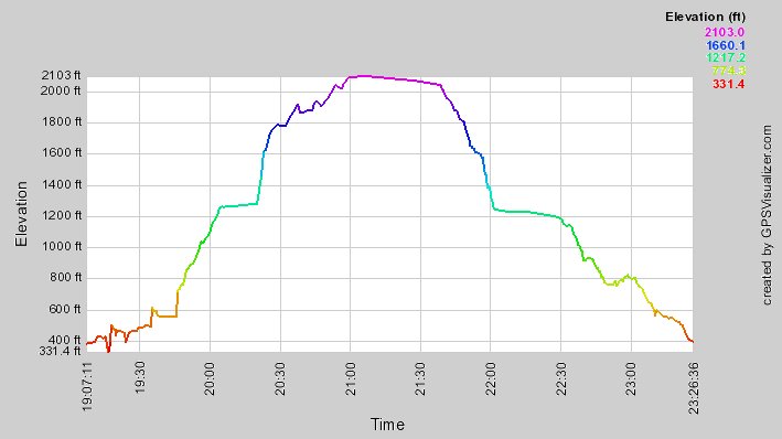
I hung around at the top from 11:00 to about 11:40 watching people coming, and for once I didn't gain altitude during my lunch stop, 12:00--12:30!
Clicking the left arrow will take you back to the topo map. Or you can get back to the overall list.


|
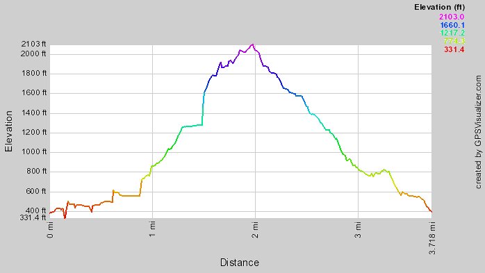
I'm a little suspicious of some of those steep uphills, especially the long one at a mile and a half, but, you know, it kinda felt like that! |
|
I always find it interesting to compare the distance and time profiles.
(subtract 10 from each hour figure to get local time). I hung around at the top from 11:00 to about 11:40 watching people coming, and for once I didn't gain altitude during my lunch stop, 12:00--12:30! Clicking the left arrow will take you back to the topo map. Or you can get back to the overall list. |