The hunters' shelter is lower right corner.
Scroll down to see elevation and time profiles below.
The long level stretch just below 2300' from 11:05~11:10 (subtract 20 hours from Universal Time shown) to 11:40~45 is our stop for lunch.


|
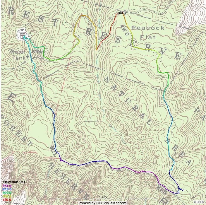
This is the course of those who did the loop,
starting and ending at "NAR2,"
with a bit of editing where my GPS got really lost in the last valley coming back. The hunters' shelter is lower right corner. Scroll down to see elevation and time profiles below. |
|
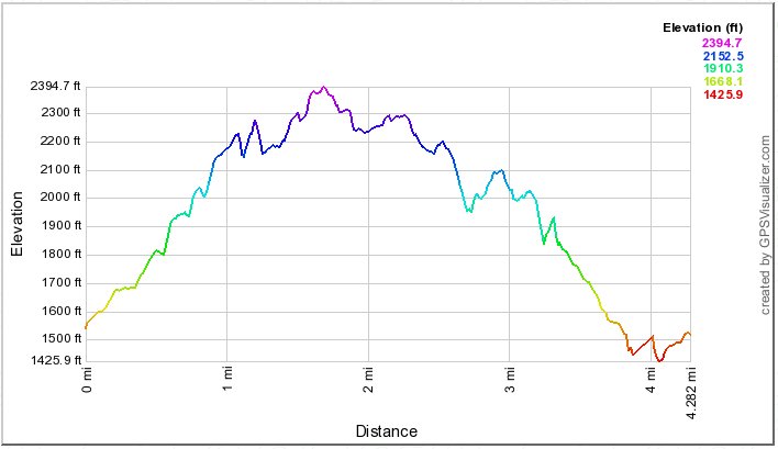
This tracks the ups and downs on that loop. |
|
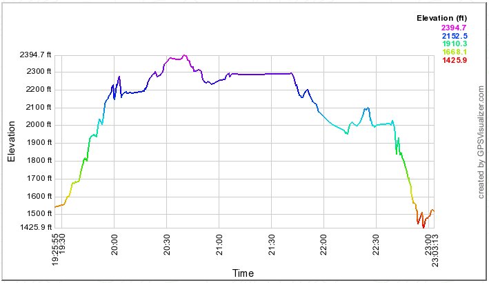
This shows how high we were (or I was) at different times during
the loop. It can be interesting to compare it with the distance profile.
We reached the hunters' shelter at about 10:00, after 30 of the "20 minutes" we were told it would take us
to get there. The long level stretch just below 2300' from 11:05~11:10 (subtract 20 hours from Universal Time shown) to 11:40~45 is our stop for lunch. |
|
|