


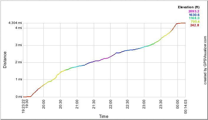
Before and after those times respectively, there is no change in distance traveled, i.e., I was standing still, waiting to go, or finished but forgot to turn the GPS off.
|
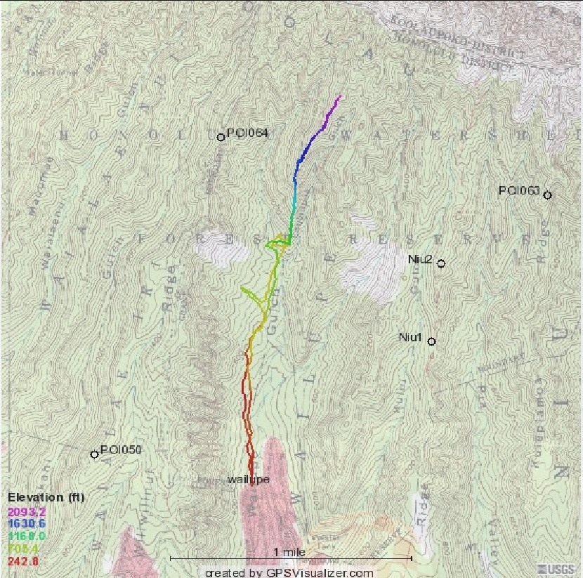
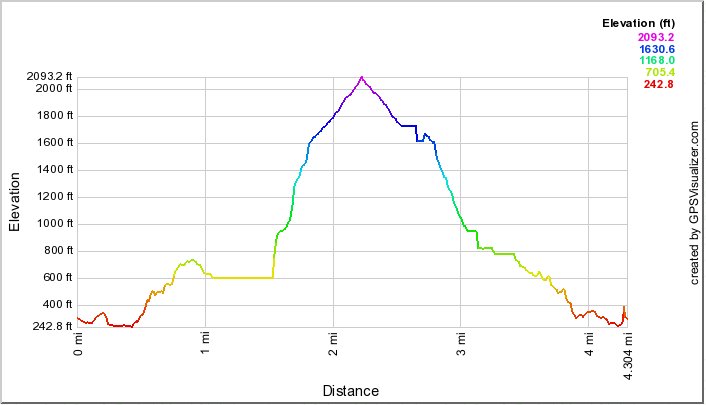
The profile below shows the length of my 2010 hike. I did not go to the summit in this version of the hike. On the other hand, I did make a wrong turn early in the hike and went about a third of the way to Wiliwilinui. But on still another hand, I didn't do all the wandering around in the area of the boy scout camp and stream crossing that is indicated on the topo above. That would be the flat yellow parts of the profiles below. |
|
|
|
|
|
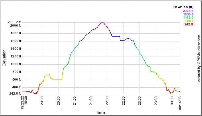
The profile left shows that I got underway just before 9:40 and finished just before 2:00. Before and after those times respectively, there is no change in distance traveled, i.e., I was standing still, waiting to go, or finished but forgot to turn the GPS off. |