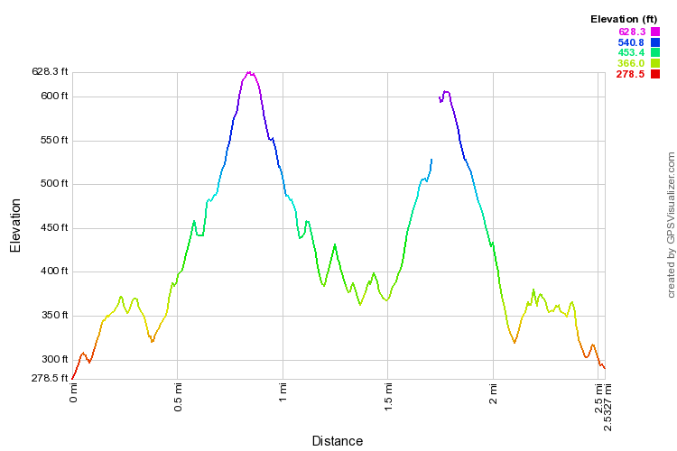
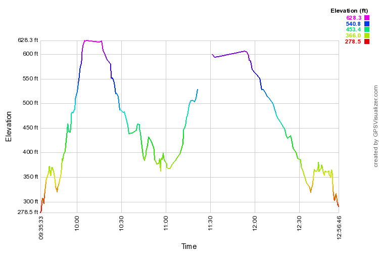
At that point, three of us backtracked to re-explore a trail we had taken in June 2014 ("Wailupe3"), turning it into a bit of a loop this time. At about 11:15 (see lower profile below; expand if necessary) my GPS asked for a battery change. It took several minutes to change and for the GPS to find itself again. By that time I had reached the point where my cohorts had paused for lunch and I joined them. This results in our lunch spot being marked on the map as the righthand side clockwise of a gap in the trail at about 600 feet. Thence we headed down a trail makai and back down to the valley.

 Four photos from our June 2014 outing