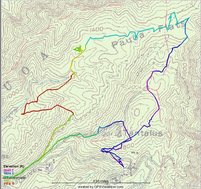
According to my Magellan Explorist 500, which lies a lot (for one thing, Pat and I did NOT cross Tantalus Road when we went slightly astray on our way around the crater, prepared to turn at the second left but missing the first one, I logged 4.893 miles on this hike.
Don't believe any of the straight lines, but this approximates the hike. Our second stop (first photo, assuming everyone but Pat, Amanda, and I regathered at the 2004 foot mark at the electronic gizmo tower before setting off down the Pu`u `‘hi`a trail, was at the upper right corner or perhaps a little beyond, where we could peek down into the upper reaches of M‚noa Valley.
Some almost(?) started lunch there but it was illegally early, so we headed out to Kal‚wahine Trail--not in the straight line WSW then 90∞ angle WNW seen here but probably north-west to the dotted line that leads to the Nu`uanu Lookout--and turned downhill off it to the right about the bottom of the "l" in "Flats." We stopped for lunch at that glob of short yellow and green lines, then headed down into the valley where the elevation-indicating color turns red and stays red until we reach Kal‚wahine, a half mile from our cars.
