 |
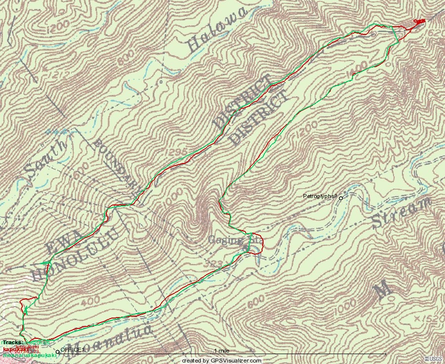
| A passable map, after considerable editing. The green track is 2010, the red 2013 (with a newer
Magellan GPS). Both instruments tended to get lost in the lunch-time pine grove (that's where 2013 got edited). Where the tracks
differ, the 2013 version is mostly more accurate, except that the difference at just above 400' represents climbing up a rock
face in 2010, and skirting it with a leftward curve in 2013.
|
| You'll have to use your browser's back-up button to get back here, but here is a live Google map of the 2013 hike. |
 |
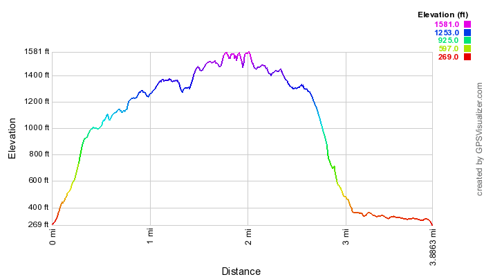 |
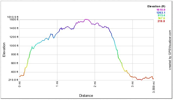
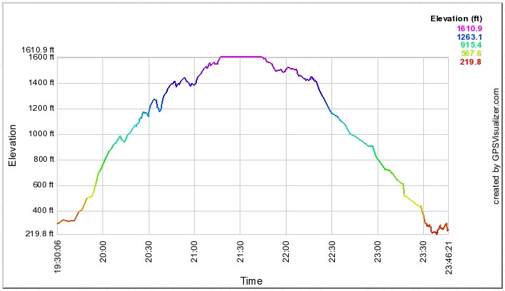
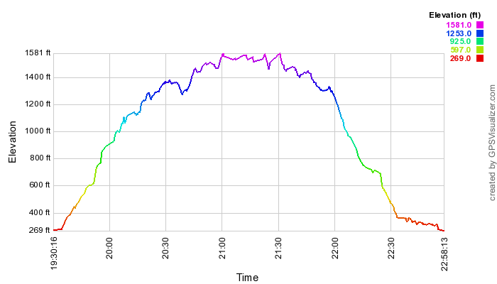
| I always find it interesting to compare distance, as above, with time,
as below. 2010 on the left, | 2013 on the right. Remember to subtract 10:00 from the GPS's UST record for Hawaii time. |
 |
 |
 |