This shows a hike (the red track) four of us did instead of the Lāʻie hike planned for June 2015. We crossed over to the Malaekahana trail, had lunch in the rain, then headed back to the cars.
The blue track is one to the falls, then a John Hall excursion on the way back.
The green one is a more or less regular hike to Malaekahana Falls.
Erase tracks that get in the way by clicking on their names in the "Tracks:" menu.
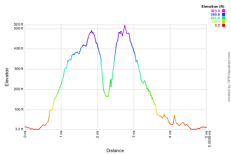
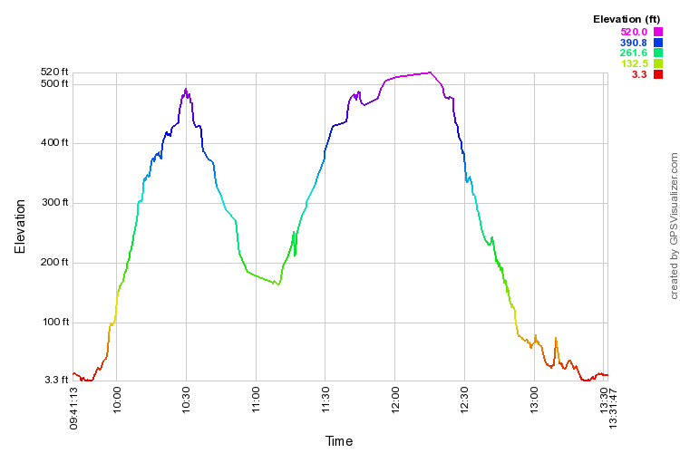
Below are expandable distance and time profiles for that Lāʻie-Malaekahana hike.