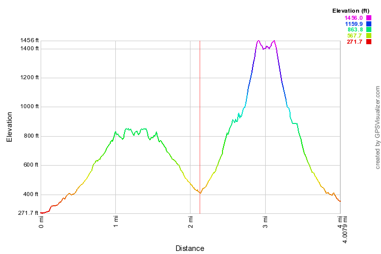
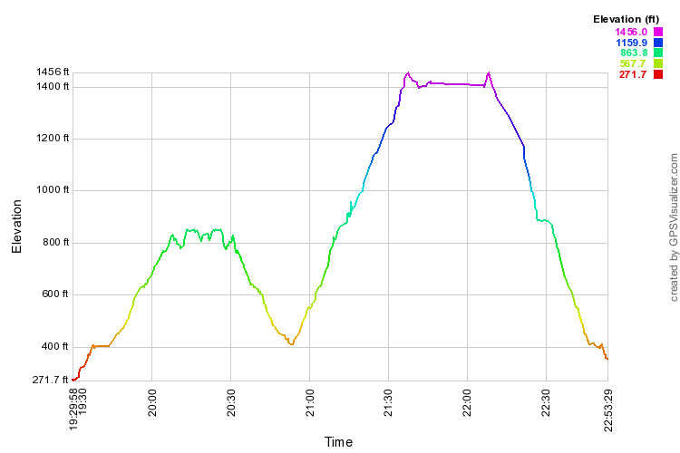
I started tracking from where we gathered before the hike; that adds something to the beginning of Puʻ Pia. I stopped tracking early on the way back.


| I had never hiked the Puʻu Pia trail. Feeling
somewhat lethargic these days, I decided to do it as a substitute for Kolowalu-Waʻahila. According to the Google map, I failed to reach
the end by about 440 feet. I had seen ribboned but not well-maintained trail dropping down from the last high point, but opted not to take it.
Maybe I'll have to go do it again. When I got back to the Kolowalu trailhead, it was only 10:53, way too early for lunch, so I elected to see whether I could go far enough up Kolowalu to find a good lunch spot before noon. A couple of hikers heading back passed me as I was climbing, and a couple bunches more while I finally did eat lunch at the level spot before the final contour climb to the top. |
|
|
These (enlargeable) profiles combine my Puʻ Pia and Kolowalu hikes. I started tracking from where we gathered before the hike; that adds something to the beginning of Puʻ Pia. I stopped tracking early on the way back. |