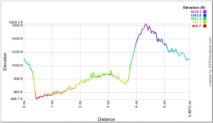
I convinced the others in my group that finishing the loop with the uphill to the Aiea Ridge trailhead would involve less of a climb than going back down stream and going up the way we had come down. The distance/elevation profile below reveals just how horribly wrong I was!
Meanwhile, there is an alternate ("contour") trail from approximately the "CT1" marker (move cursor to marker to read name) to the "CT2" marker that, had we taken it, would have made this a real sissy hike. :-)
In 2013 we did it the usual counterclockwise fashion. Again I didn't turn my GPS on until late. (You can erase tracks temporarily by clicking on their names, and you can select other map formats.