| GPS |
|
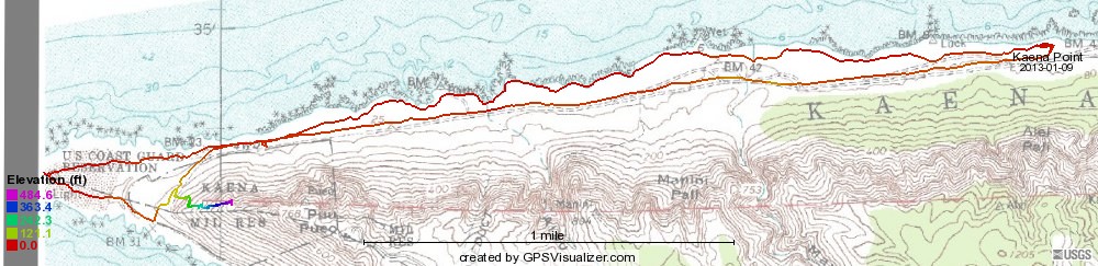
| Topo map |
| Google map | |
| This is a live Google map; zoom in or out, change map type, whatever. I have included two tracks, one showing the 2013 hike from the Mokuleʻia side and one showing the optional hike from the Waiʻanae side in 2014. You can select a track by clicking on the name of the other to get it out of the way. You can also slide the name box out of the way.    Scroll down for distance/elevation, time/elevation, and distance/speed profiles. |
| 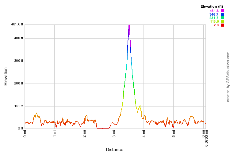 |
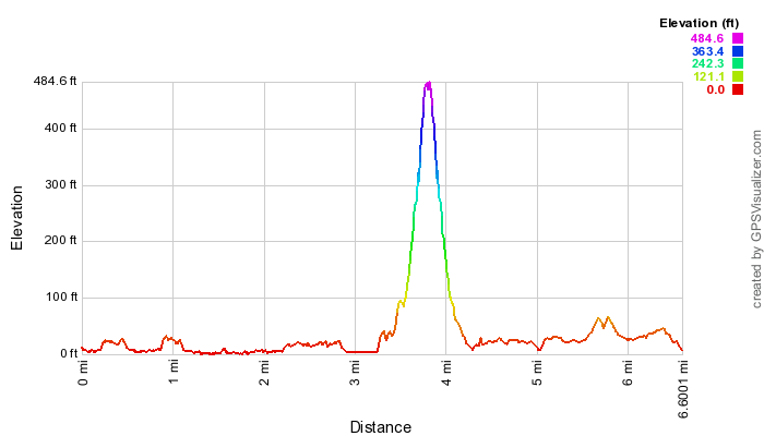
Hike length and elevation for those of us who went to the top bunker, 2013 on left, 2014 on right.
I assume these are easily brought up to true size. |
 |
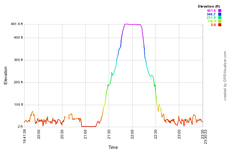 |
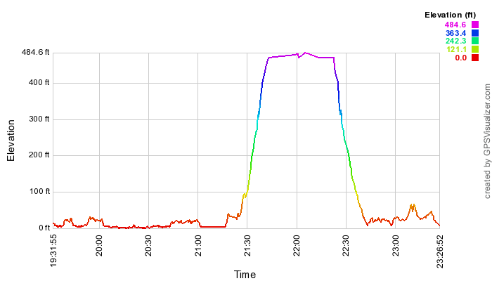
Just how long it took me, personally. (Hawai`i time is 10 hours earlier than that given.) |
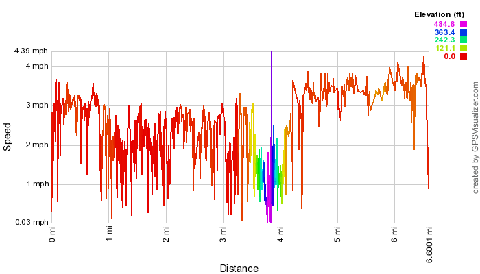 |
Can you tell I wasn't lollygagging on the way back to the parking lot? (2013) |