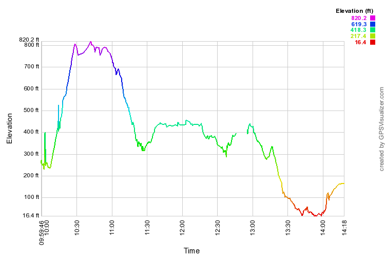
I took a lot longer on the hike than some other hikers. I was the second to arrive at where Steve and I stopped for lunch, but many did not stop, hurrying off to the party at Joe and Ruby's. I did not slide downhill while eating lunch. I can't explain that sloping line. Elevation is supposedly based on US survey maps. (Subtract 10 hours for Hawaii time.)


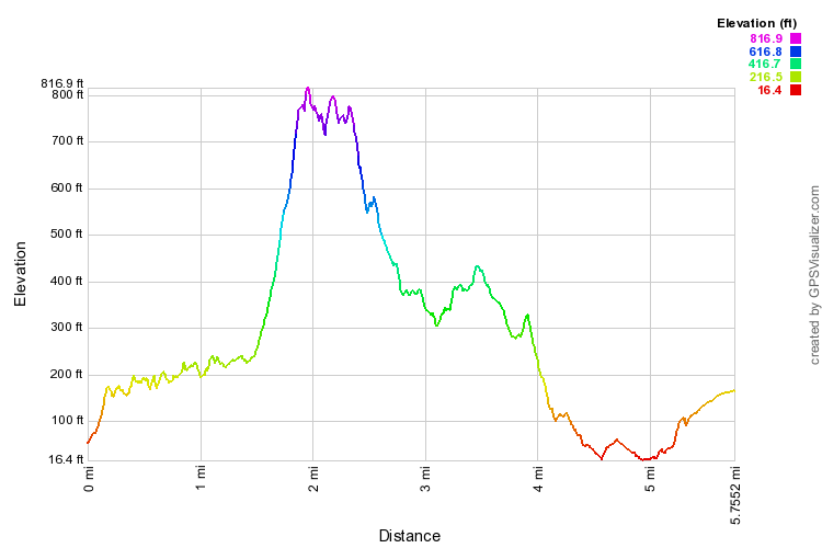
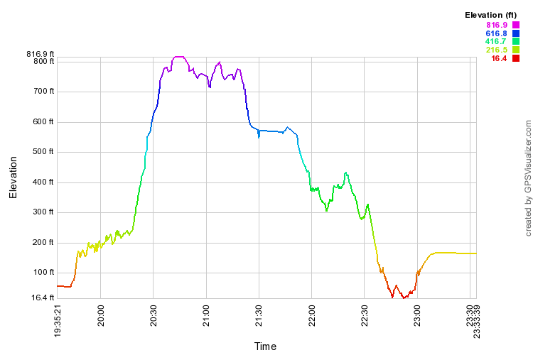
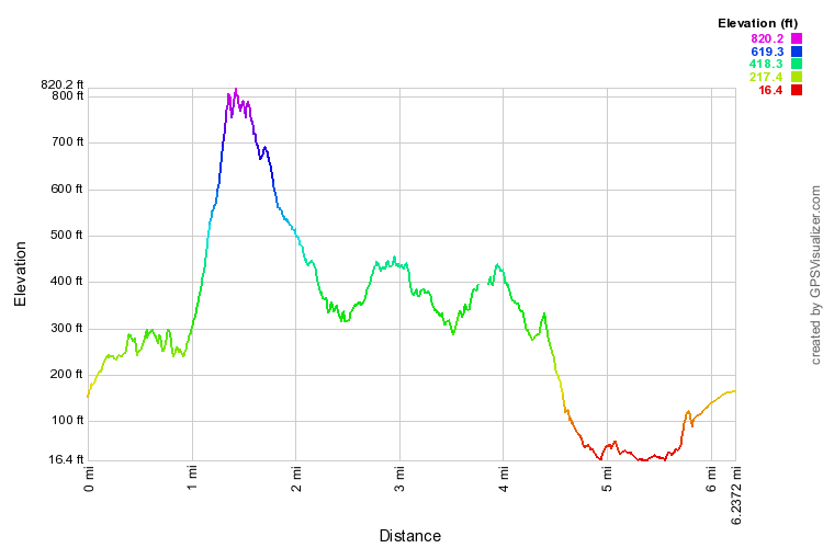
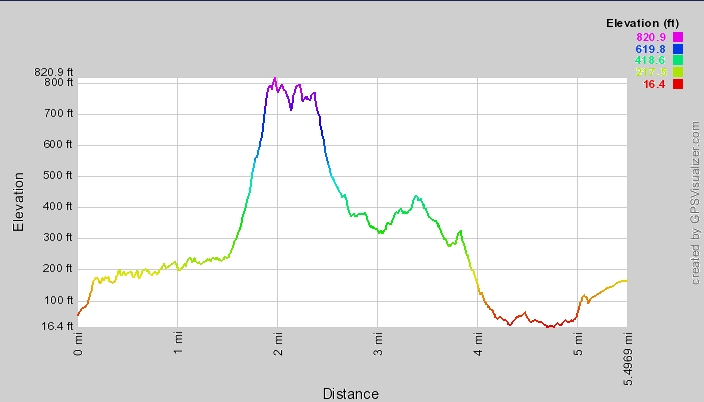
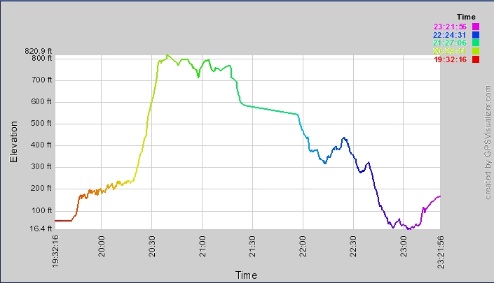
These profiles show a couple of phony peaks early on (notice how quickly it says I climbed up and down a hundred feet or so), and I didn't notice for 10 minutes that my GPS batteries had died at 12:45. The time profile starts late; I forgot to start my GPS! (@#$%^* senility!)