"Aiea Venture" started at the top of Halawa Heights Rd., and judging from the map it could have reached Aiea Loop much earlier than it did. The way we went was pleasant and got us to the Loop trail soon enough, but we certainly could have shortened the hike on the way back by 1000 m. or so.
To remove one track for better viewing the other, click on the name in the box. You can select other map types from the drop-down menu.


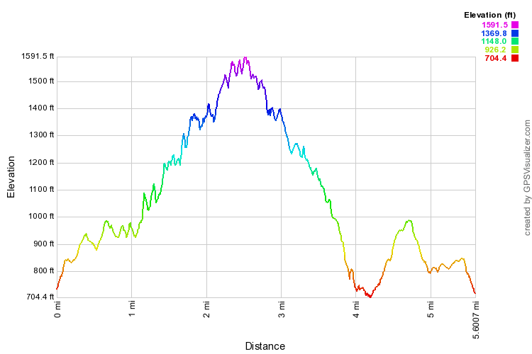
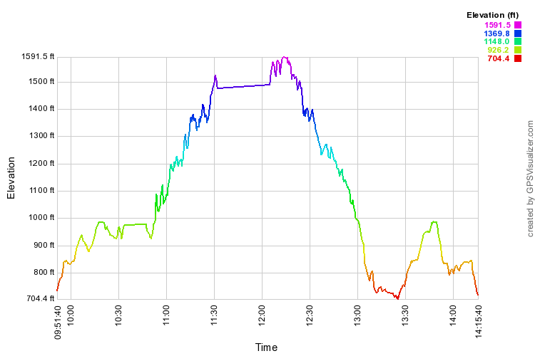
The profiles below apply only to the 2014 hike. They should be easy to expand for legibility.